

Qilian
Hiking Guide

The hiking route.
After a big stint of rubbish weather finally Taipei was blessed with some good weather, so I decided to explore an area I haven't been much over the last year of hikes. This hike starts out at Qilian MRT station, the trail entrance is fairly well visible from the exit of the MRT. The start of the hike is a little tricky to follow. There are several small trails that head all around the initial start of the park. Admittedly I did get a bit lost and had to ask directions from a local chap who very kindly showed me the a majority of the trail.
If you are heading out on your own just follow the trail up instead of the parallel trails there. Once you reach the top of the ridge and from there you have a pretty simple route over the ridge that offers some nice views either side of the path.

A view of the red MRT line. 35mm, ISO 200, f/2.0, 1/2500

A panoramic of the ridge line. 35mm, ISO 200, f/2.0, 1/2500

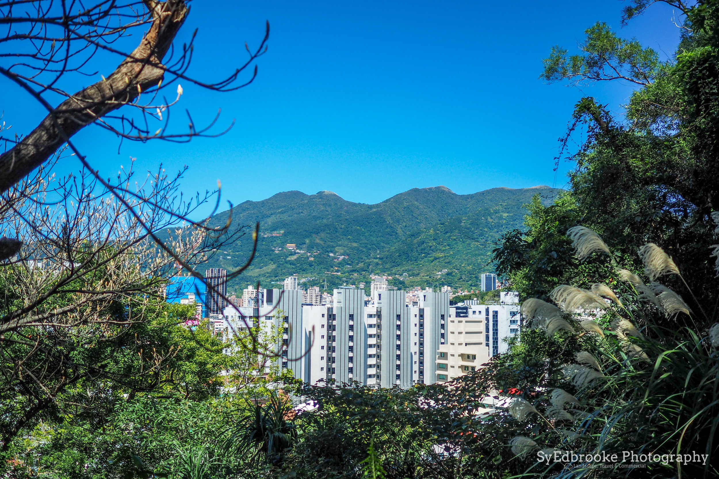
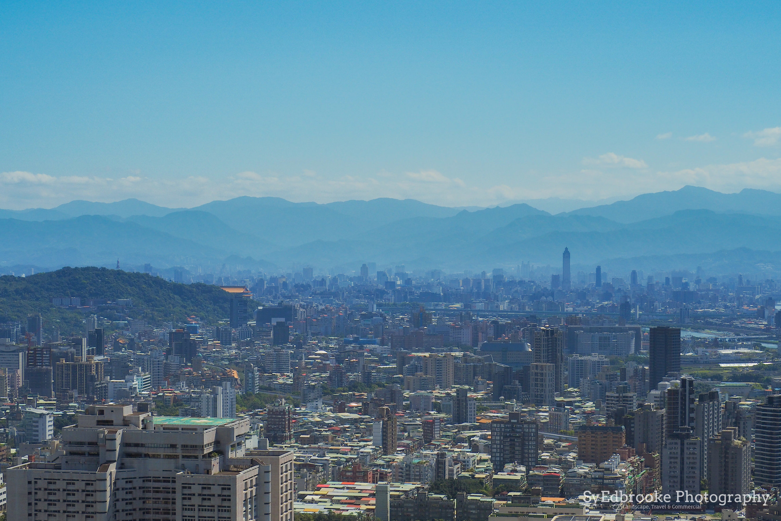
The trail goes over a couple of smaller peaks and over a very secluded smaller trail and comes to a smaller junction. You can either carry on the path that leads over a rope section for the more adventurous among you, but if you aren't looking for a bigger challenge you can join the road that leads to the sports track that belongs to the university. It's a really nice little area that has an awesome view over Taipei!

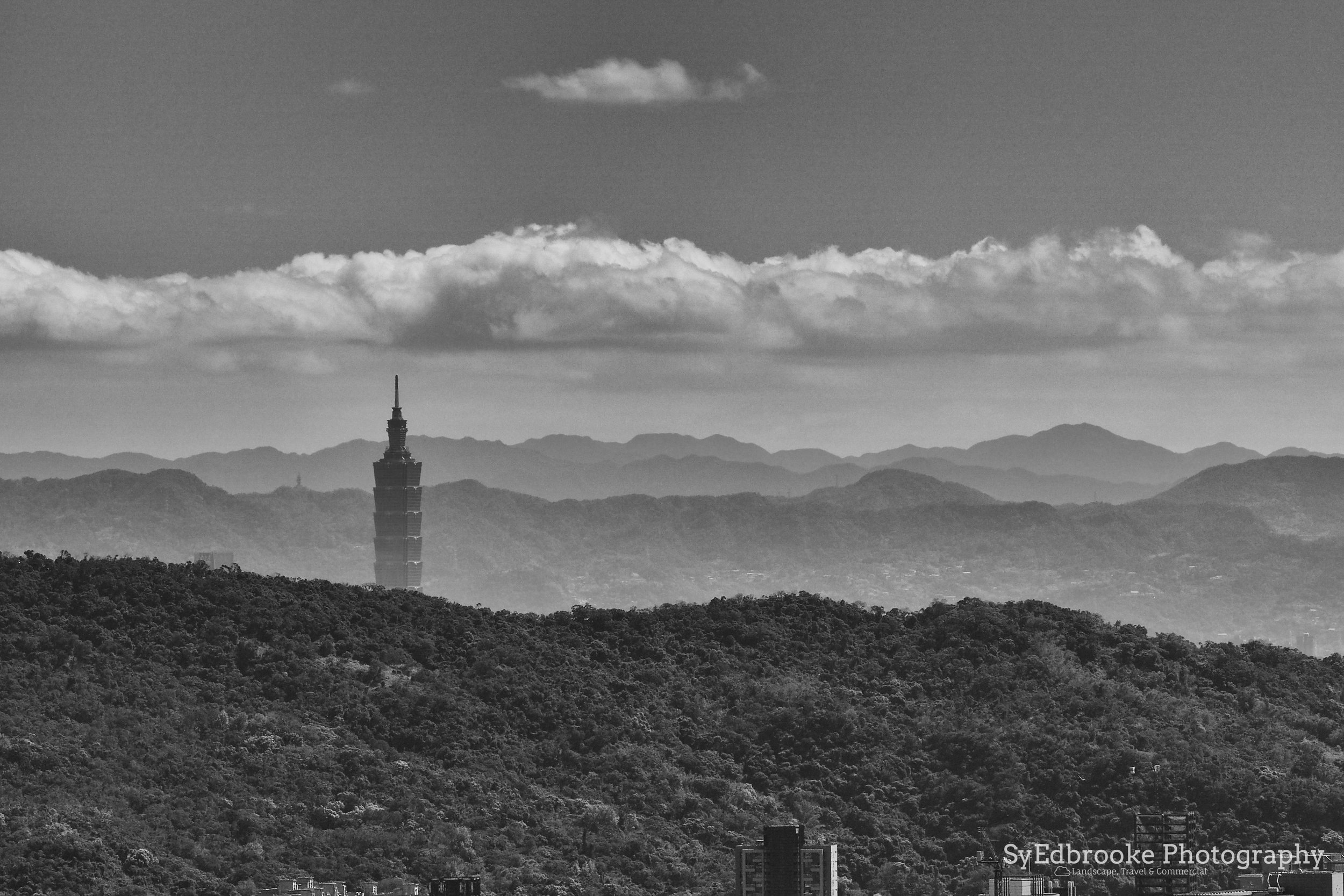
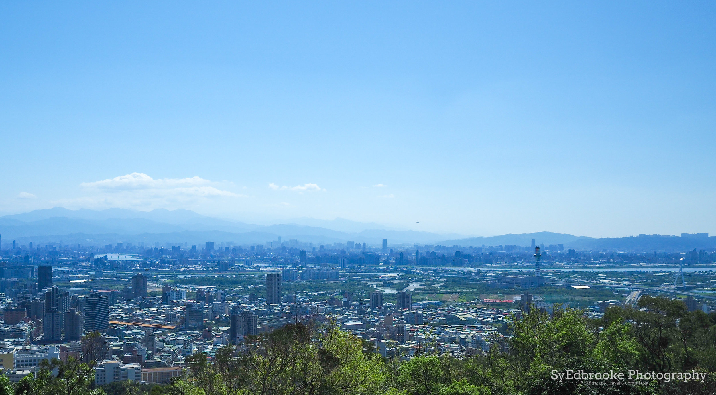
probably the furthest I've been able to see in a long time. Not sure which mountain that is in the background but there is snow! 120mm, ISO 200, f/13, 1/320
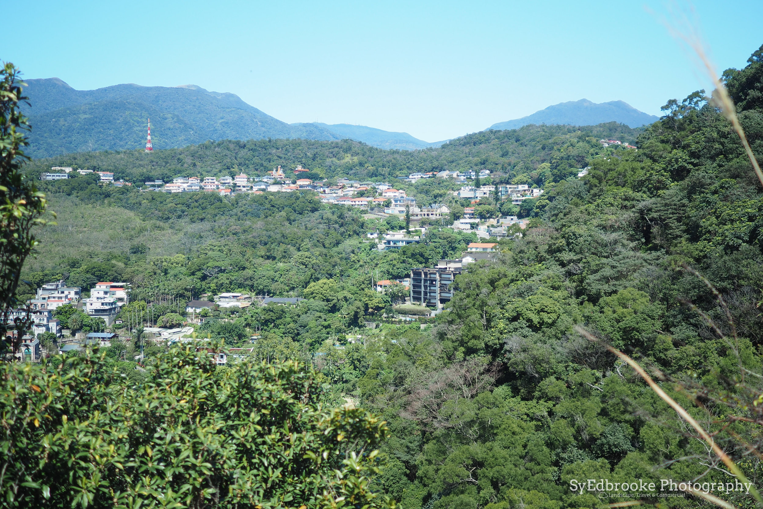
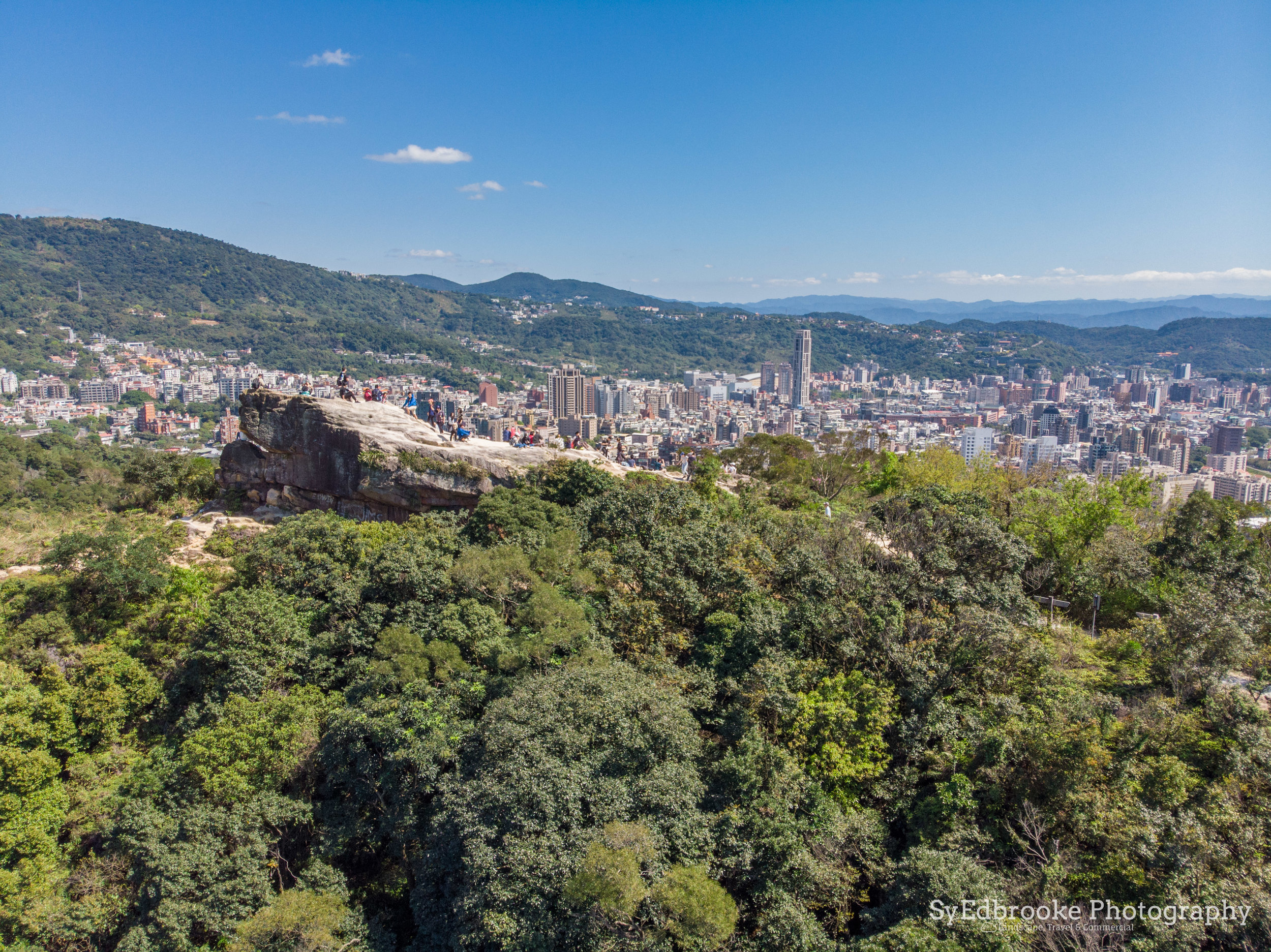
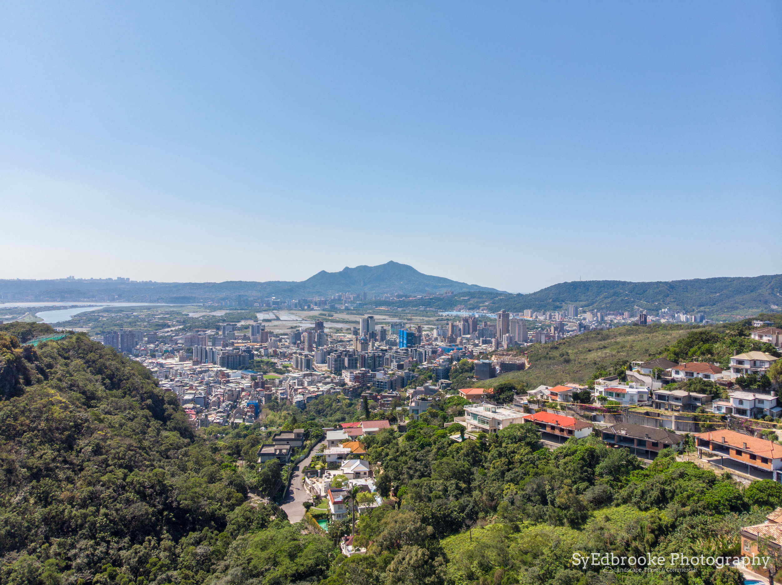
From the sports track the trail winds down a rocky cliff face, it is quite sandy here so be careful on the way down and go slowly. It leads to the main trail that can take you down towards the university campus and MRT. Instead of going left, follow the trail up the opposite side of the small canyon. From there the trail is pretty easy and is paved steps up towards the big overhanging rock. I was able to fly the drone up and get a couple of cool little snaps which was pretty fun. It gives a cool perspective on a pretty busy photo spot!

the awesome chap that very generously showing the whole trail length!

The trail heads back down through the university campus and leads towards the MRT. It's pretty easy to find the way from the bigger overhang rock. It is a great little trek that takes about 3 hours and is the perfect short little day hike for a intermediate hiker! I enjoyed the little trail and it's great short excursion for the hikers in northern Taipei!
I hope you enjoyed this little trek!
Until next time,
Sy E