

QingTianGang
Hiking Guide
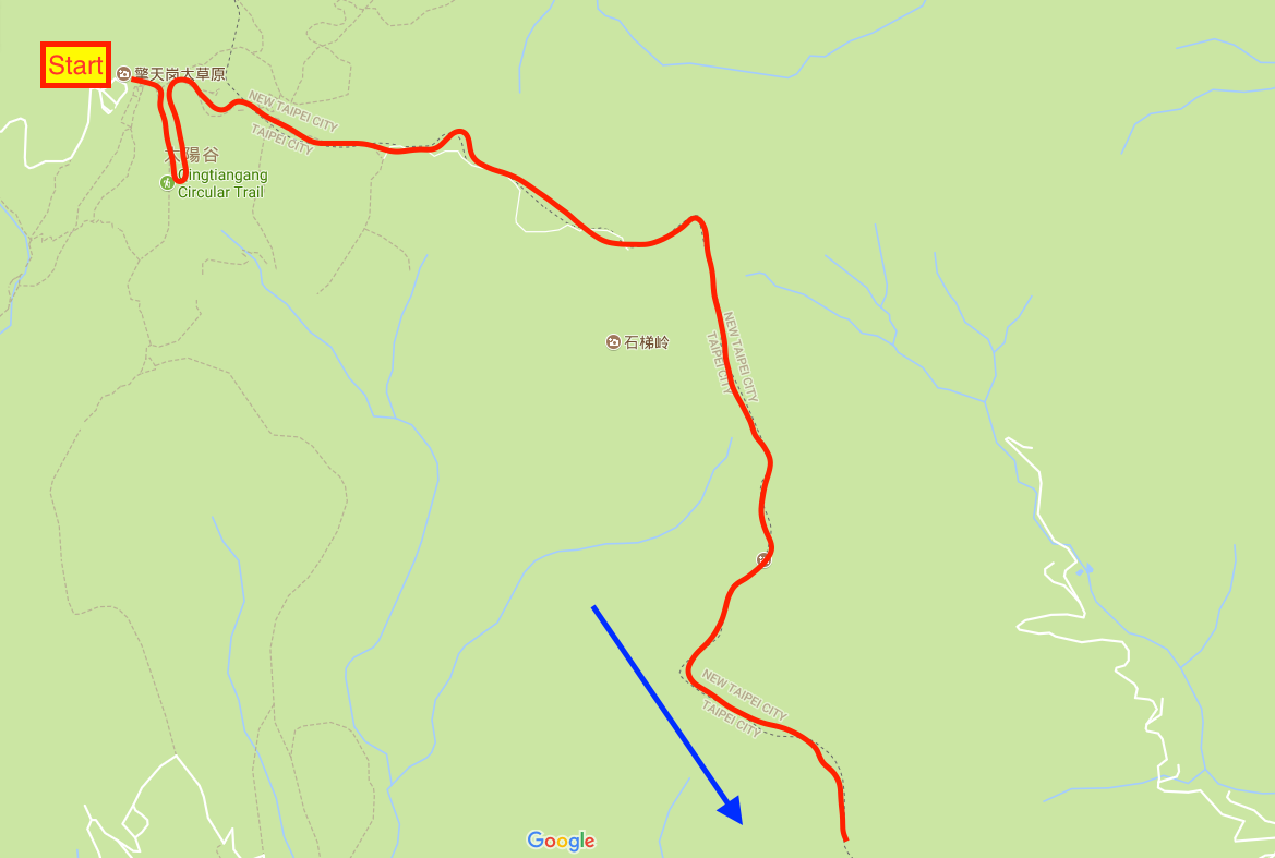
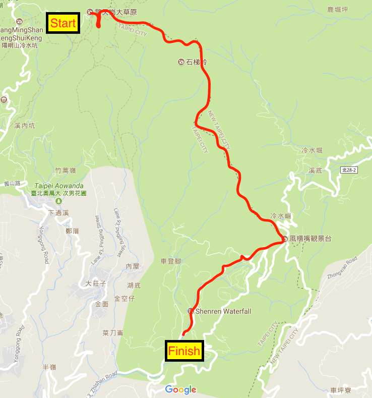
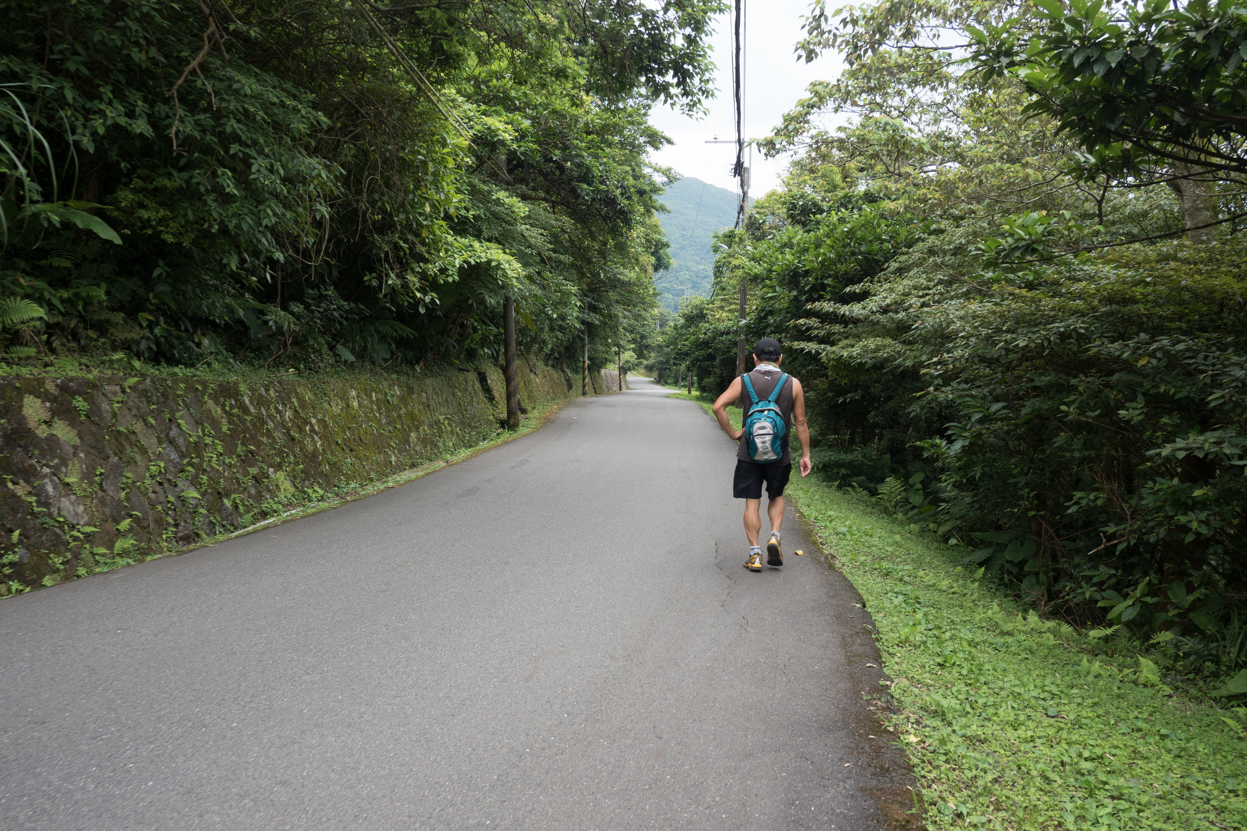
This hike is one of the longest I've do so far in my time in Taiwan. For the most part I've always been able to finish most hikes in 3 to 5 hours, This one took the entire day. It's certainly not for anyone with limited cardio or lower fitness levels. The hike itself isn't super vertical like others in the area, but it is very long. I started hiking here around 10am and I didn't get back home until 9pm that evening. So just be warned, it is a very pretty trail and can provide some pleasant views, but it requires quite the trek to complete. To get to the start of the trail, catch the S15 bus from Shilin MRT. The bus is pretty small and cramped, so I suggest you try to get there fairly early to beat the midday hiking crowds that take the same bus up. It takes about 90mins to get to the pastures of QingTianGang from Shilin. Traffic is normally better on the way up, compared to the way down.
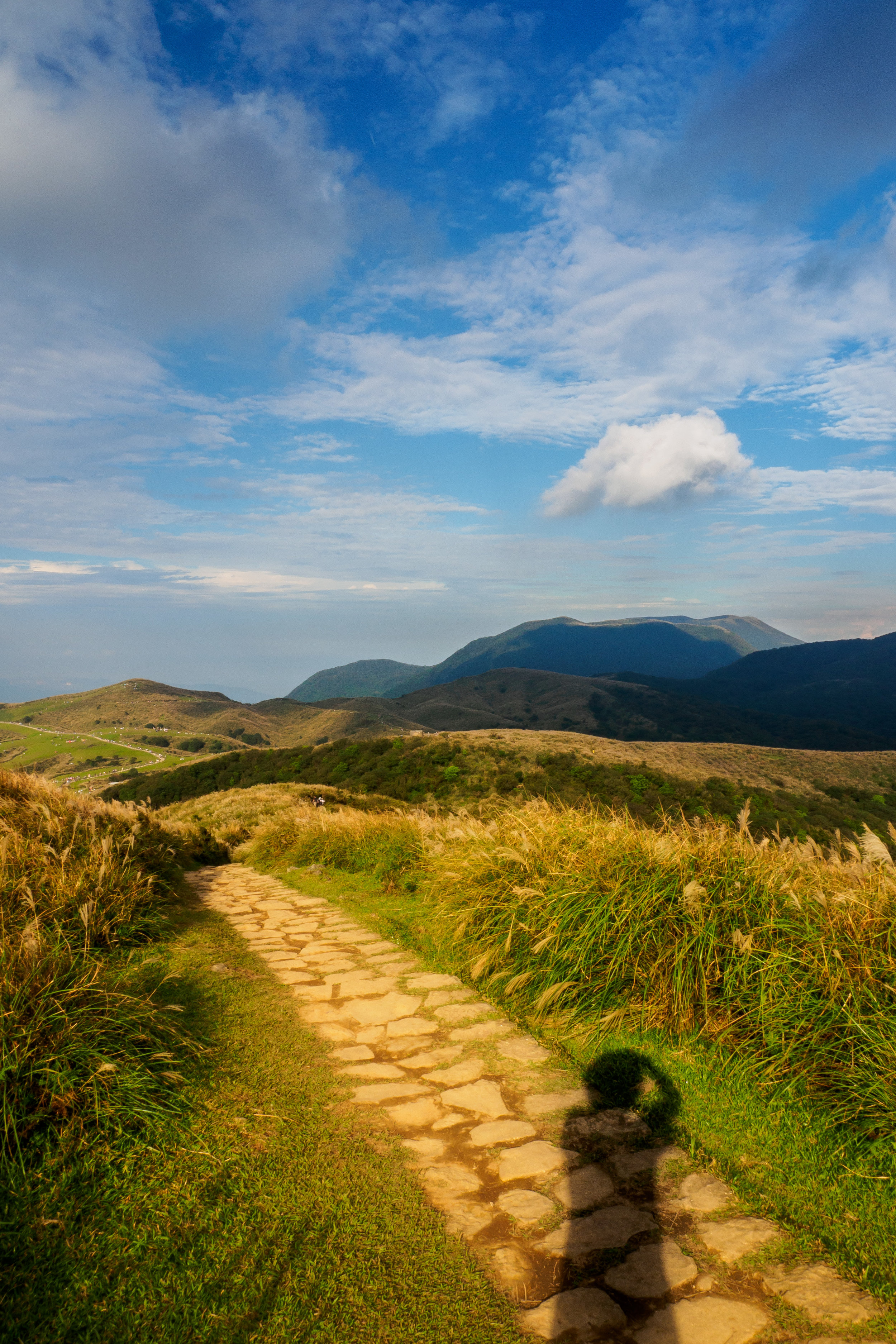
I have hiked here twice now, once was when it was a sunny day, the other when it was a much more overcast day. I'll combine both these hikes as they are fairly close to each other, but they can be done separately also. The first mini hike is when you take the right hand path towards the smallish mountain. There are two paths that lead left and right close to the entrance to the pastures here. The right is much shorter hence why I suggest you go here first. It has some stunning views of the East summit of YangMingShan, and Taipei 101 in the opposite direction.

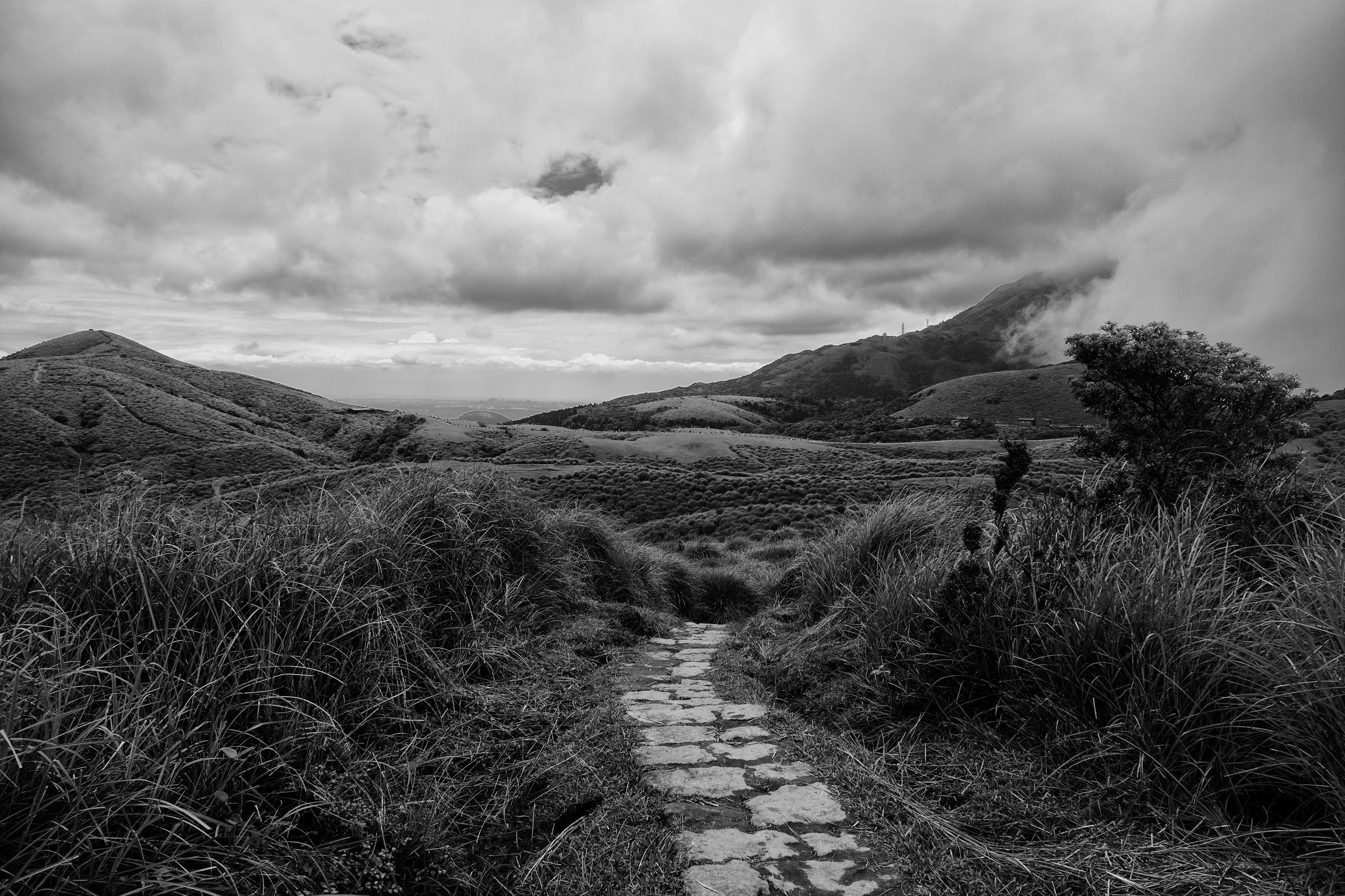
The path to the pastures. f5.6, ISO 200, 1/160, 24mm
The path transitions from long open fields to the head high golden grass all the way to the summit. From here you, if the weather is good you are able to get some great angles on the Taipei basin and YangMingShan National Park. The light can be fairly harsh there though, so try to pack some ND filters for sure. There is generally a lot of haze that covers the Taipei City basin, so having a polarizer to cut through the muck is also very useful. If I were shooting in the Uk or elsewhere you don't always need a polarizer but sadly here, the pollution is so bad nowadays that it's almost always needed if you are shooting near any major cities.
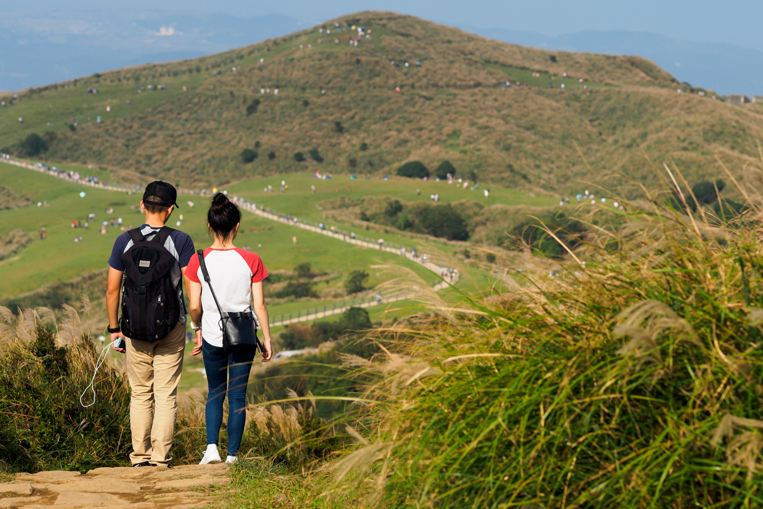
In this central area close to the green pastures you'll find the majority of the crowds of weekend tourists enjoying the large green space and fresh air. Around graduation time, many students take the bus to this location to take photos in all the hats and gowns too! I haven't hiked here on a week day, but I guess it would be a lot less busy than a sunny weekend. You can get some interesting pictures people watching here too. I also found that the grass provided a nice subject for some macro photography. I used my 75mm prime and 43mm variably zoom to good effect!

the long grass. f1.8, ISO 200, 1/2000, 150mm

The green pastures of QingTianGang. f4, ISO 200, 1/1250, 150mm

East Summit as seen from QinTianGang Summit. f22, ISO 200, 1/80, 24mm (stitched)
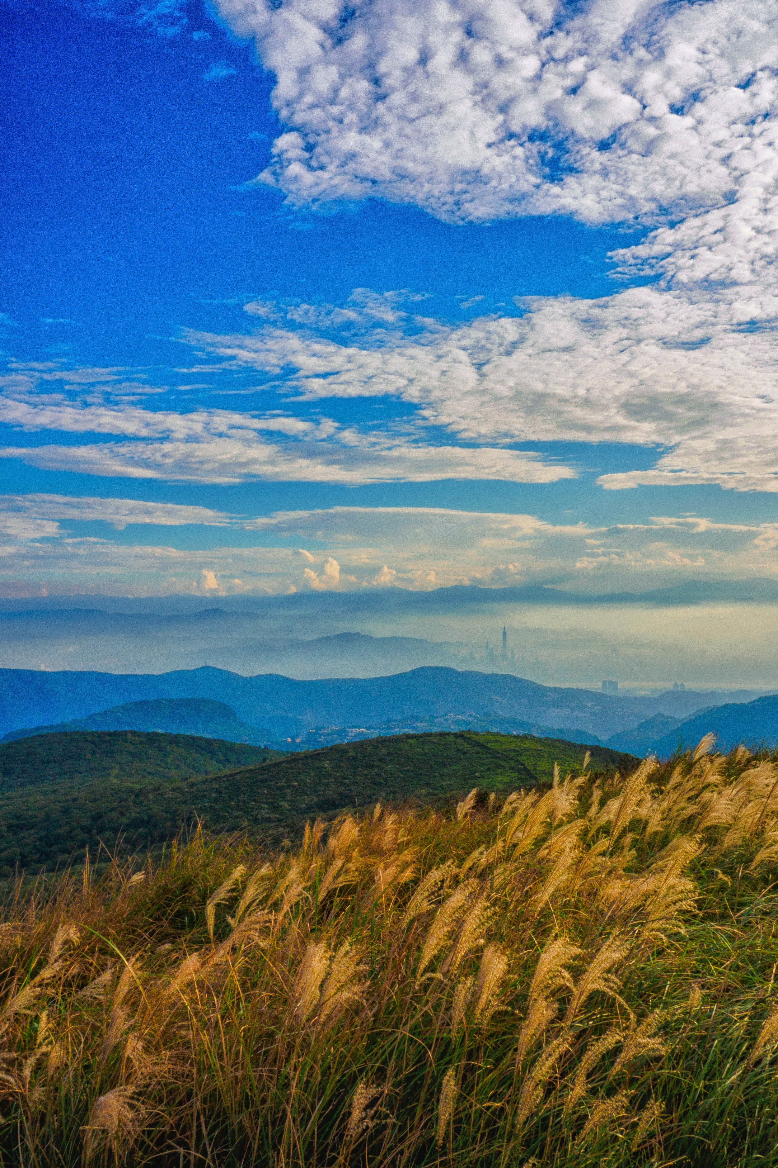
One of my favorite pictures was taken here actually. The rolling hills lend themselves very nicely to black and white landscape pictures. I used Nik Collection software to edit the conversion, and shot the RAW file with my 75mm prime in order to get closer in to frame the picture correctly. 101 stood out nicely from the haze, and created a nice contrast to the rows and rows of mountains in the back and foreground.

101 rising up out of the smog. f11, ISO 100, 1/100, 150mm
Once you have had enough of the summit views at QingTianGang, head back down the path the main the path close to the bus station and take the left path this time. The second time I came to hike this direction specifically I didn't really know exactly where I was going. I just decided to pick a direction I hadn't been before and see what I might find. This particular day I hiked here, the weather was dramatically different to the first time I was here. On the YangMingShan, the weather can change on a dime. One minute it might look clear, then the clouds will roll right in. This particular day the clouds began to engulf the pastures 20 mins after I started my hiking there. I made the best of it though, and in actual fact they provided some spectacular BnW photos of this cloud tsunami!
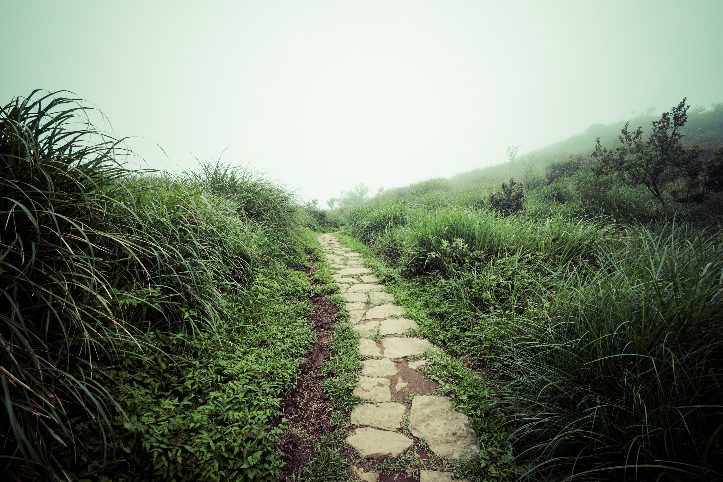
The path is fairly flat for the first 20 mins or so, it leads to an opening of part of the national park that requires a hiking permit I think. I don't know exactly as I didn't have time to explore, but it was in the opposite direction to where I wanted to go.

on the left path looking at the right one. f4, ISO 200, 1/2500, 14mm
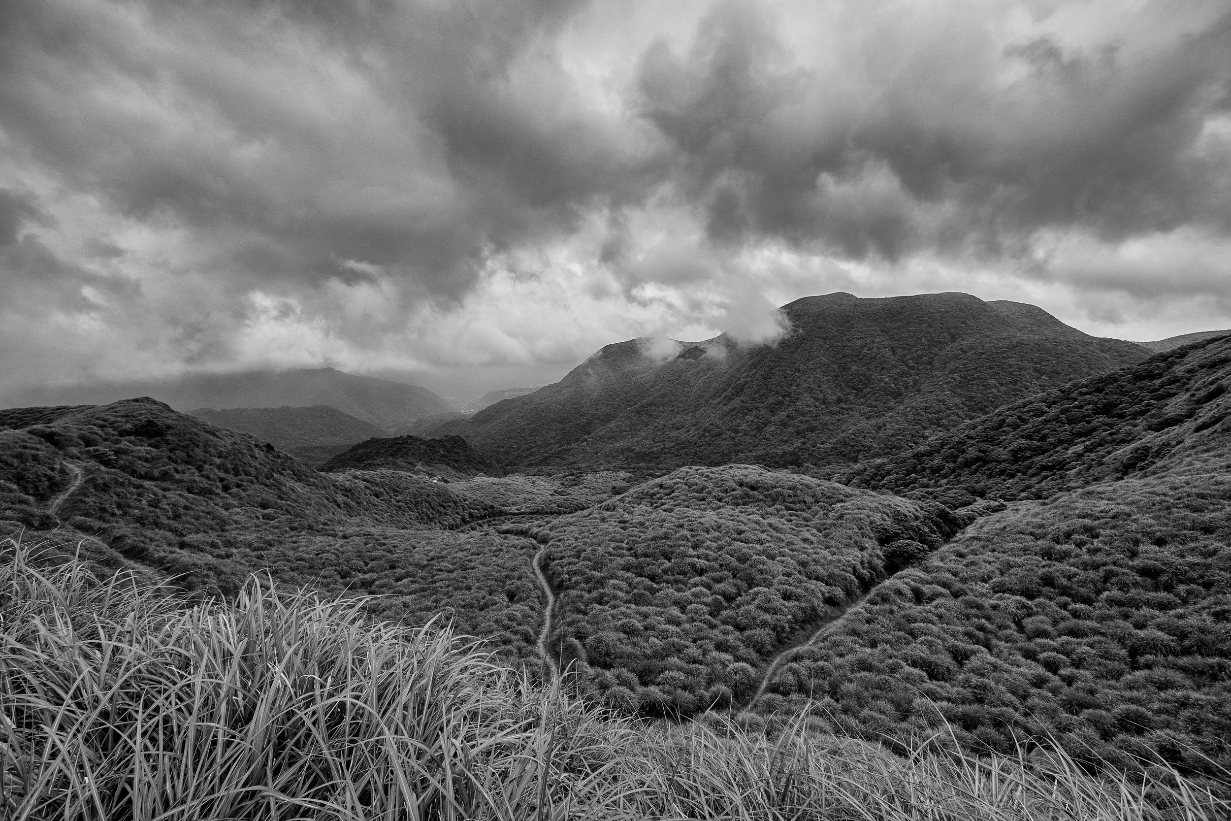

The clouds rolling in over QingTianGang. f5, ISO 200, 1/1250, 28mm
It made for quite an interesting little challenge to try and stay ahead of the cloud as long as I could. After about 2 hours of hiking up and down the mini hills and various peaks and valleys, I came to another much smaller picnic / pasture area. There were a few other families who had made it this far, but there was significantly less people compared to the main fields. On a clearer day I can imagine you would have a nice nicer view from here, but the cloud had already started to catch up to me at that point. On the rare occasions it snows in YangMingShan I can see this being a great place for sledging though!

the second pasture on the path to Shenren. f7.1, ISO 200, 1/400, 16mm
From here, the trail becomes significantly more covered and surrounded by forestation. At this point the shelter was welcome though, as it saved me from the light rain that was starting. The path from here on out was covered by thick forest and bushes. There wasn't the most exciting photographic opportunities around here, but luckily there was one small patch of forest that stuck out like a sore thumb. According to the information boards on the trail, When Japan colonized Taiwan, they attempted to plant Japanese pine species of tree in this part of YangMingShan. Due to the winds and typhoons that often batter this side of the national park, most of the non native trees died off apart from a small valley that the hiking trail goes through. The moss and vivid colours in the forest made for some nice dreamy, almost slightly surreal pictures. If you take pictures with a slightly soft focus, it looks like a magical forest I think!

Japanese pine forest. f 7.1, ISO 1600, 1/50, 28mm

The empty trail. f7.1, ISO 1600, 1/50, 20mm

Magic moss and pines. f7.1, ISO 1250, 1/80, 28mm
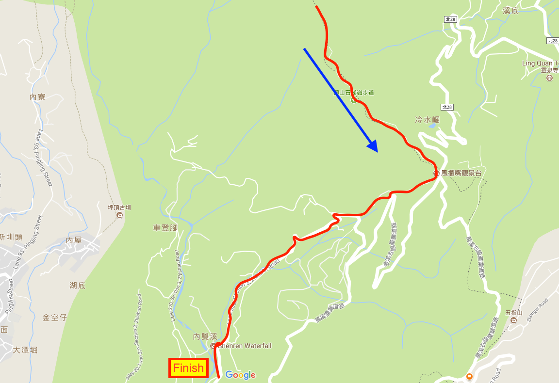
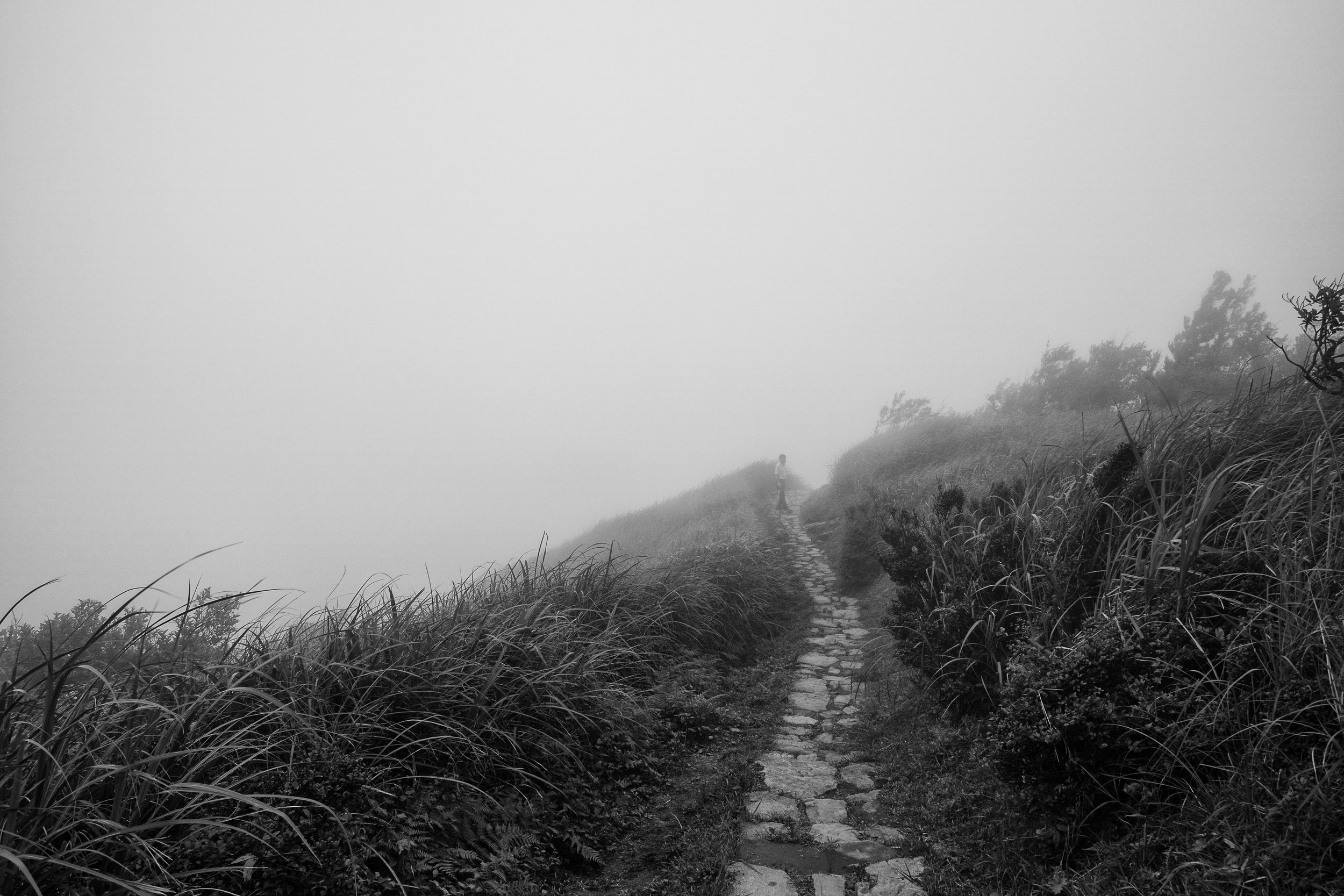
From here the path leads up to other peak, although at this point I could barely see 200 feet in front of me. From what I could gather from the various signs and tourist guides that were dotted along the trail, the views from this particular summit looked towards the east coast and the valleys there. Using the cloud to my advantage though, I was able to get some mysterious shots of the cloud and long grass wafting over the mountain summit. It was incredibly quiet and peaceful here, and not busy at all. It's the perfect hike if you want to get away from the crowds around the main peak and green pastures of QingTianGang. Even on a weekend, which should be the busiest time during the week, I barely saw any other hikers on this part of the trail.

The solitary trail into the clouds. f7.1, ISO 200, 1/320, 14mm
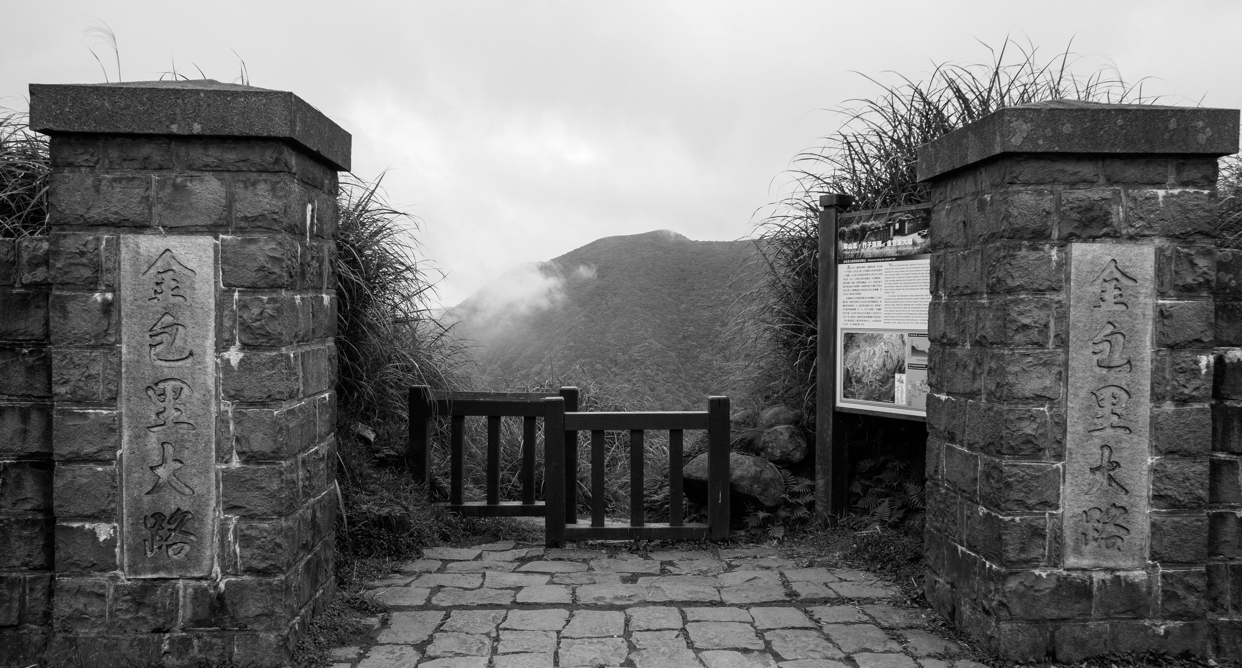
Once I made my way down the trail the entrance at Mt. Shiti I followed the small path towards Shenren waterfall. It's fairly well sign posted, just go left once you exit the trail. If you are unsure you can follow the road if you don't want to get lost. The pedestrian path cuts out fairly large U turn corners though. From here to shenren took about 2 hours I think. I didn't time the total it took to complete the hike exactly as I was mainly focused on taking in the sights and enjoying the quiet. The roads were fairly Empty and safe to walk on also. Just take care on the corners as there was the odd car and moped speeding around the sharp turns. I passed a centre for a national nature reserve on the way down this road, I think it is where you can apply for / and pick up permits for hiking in the some of the restricted zones of YangMingShan national park. It's something I interested to do in the future, as I've already hiked many of the public trails here. I guess it's an adventure for another time though!
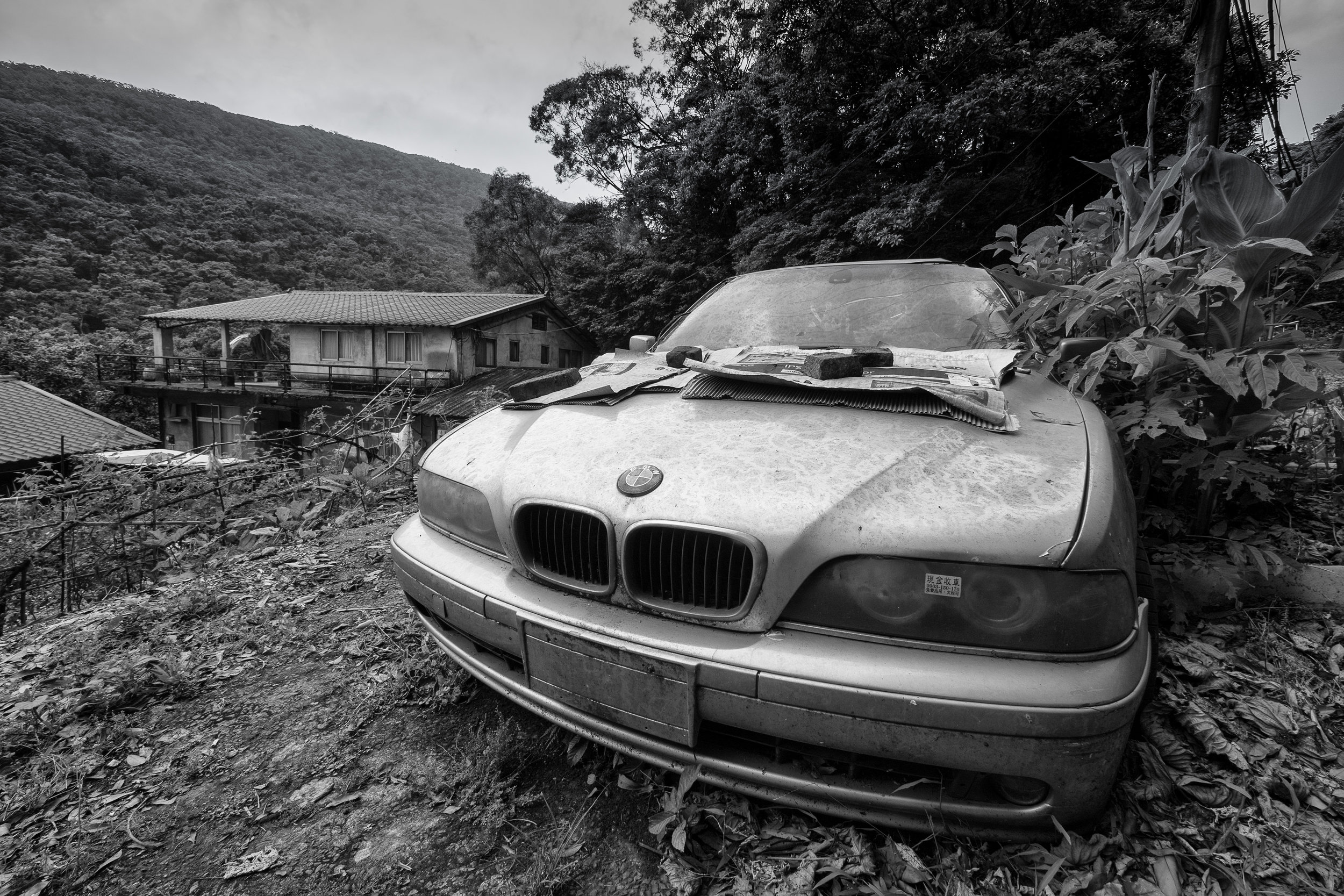
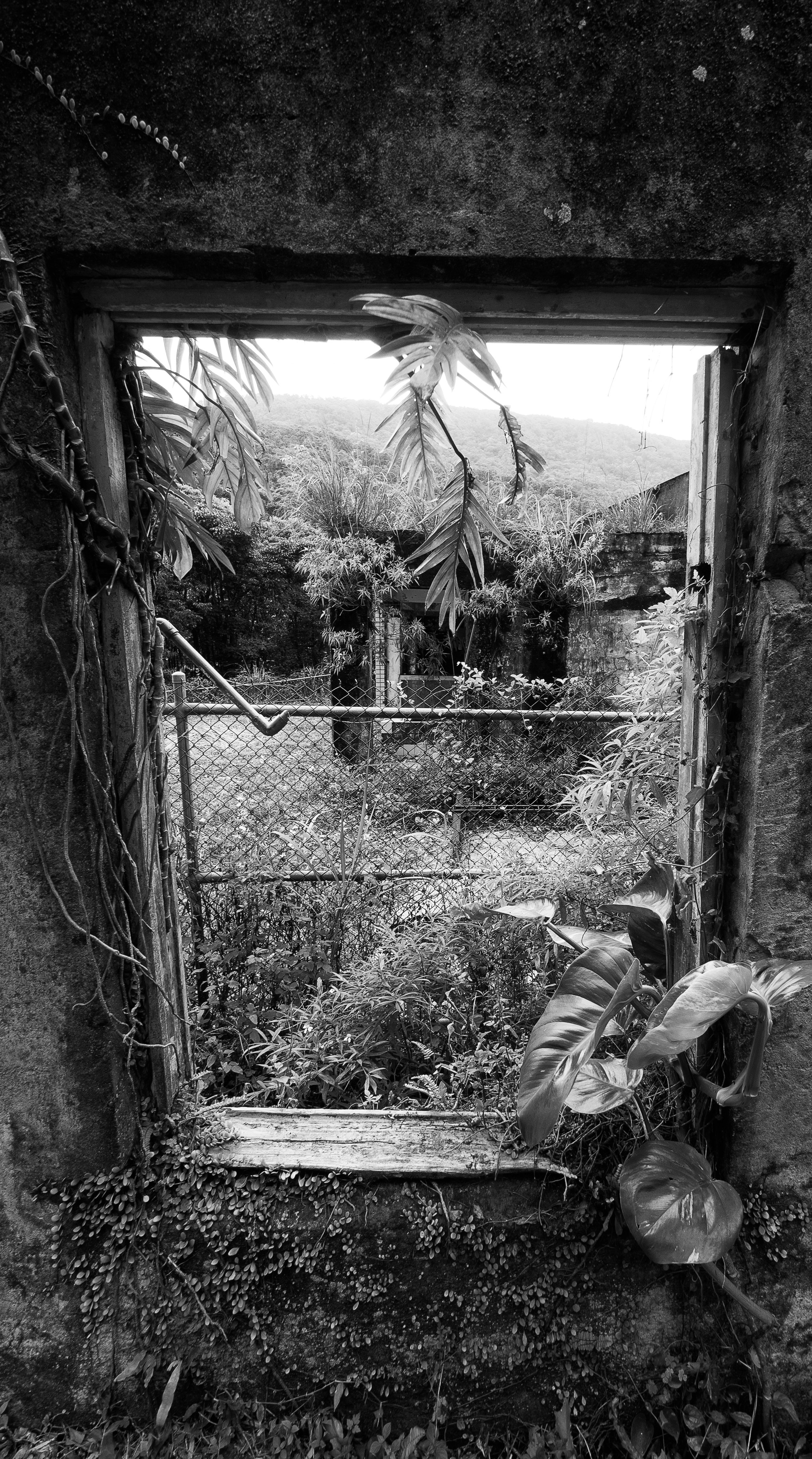
There were one of two interesting looking abandoned cars and old buildings that made for some good street photography compositions also! It's worth keeping your eyes open for the not so obvious compositions on the second half of this hike!
Once you make it Shenren waterfall, cross the bridge and catch the S18 bus back to the red MRT line. I had 30 min wait or so for the bus, but keep in mind this was the weekend, and sometimes on weekdays buses aren't as regular in this part of YangMingShan. I personally think it's a very rewarding hike, but it is a long one. It took me at least 8 to 10 hours to complete and I was going at a fairly quick pace. The trail is clearly marked though, and easy to follow on the mountains. There were some muddy patches, but for the most part I would say it's suitable for most trainers or comfortable running shoes. Weather here is very changeable, so pack a waterproof coat, snacks and lots of water. You'll need the extra energy to get from start to finish!
For the hardy Hiker, it's a fun adventure to see a slightly different side of YangMingShan. Everyone always hikes the main peak, but not many people explore this part of the national park. I hope this guide has helped somewhat, and given you photographic inspiration to go out and capture your own adventures!
Until next time!
Sy Edbrooke ^^