

Bitoujiao
Hiking Guide
Bitou is the first hikes I ever completed in Taiwan. After two years of non-stop English teaching and being stuck in the city more or less, I was pretty fed up with the hustle and bustle of Taipei. I decided to try look up google maps and find the furthest accessible point I could get to in a day from Taipei. I settled on Bitou, Found the right bus (791), and went to see what I could find. I will always have a soft spot for Bitou, as it was the hike that set me on this path of exploring and capturing this island I've called home for 5 years now.
That is one of the most unique and endearing aspects of Taiwan I feel. The landscapes here are so diverse for such a small island, one day you could be hiking up a dormant volcano and the next chilling on a beach in Kenting. I only really got into hiking and exploring over the last two years, but I can safely say it's been the saving grace of living here for me personally.
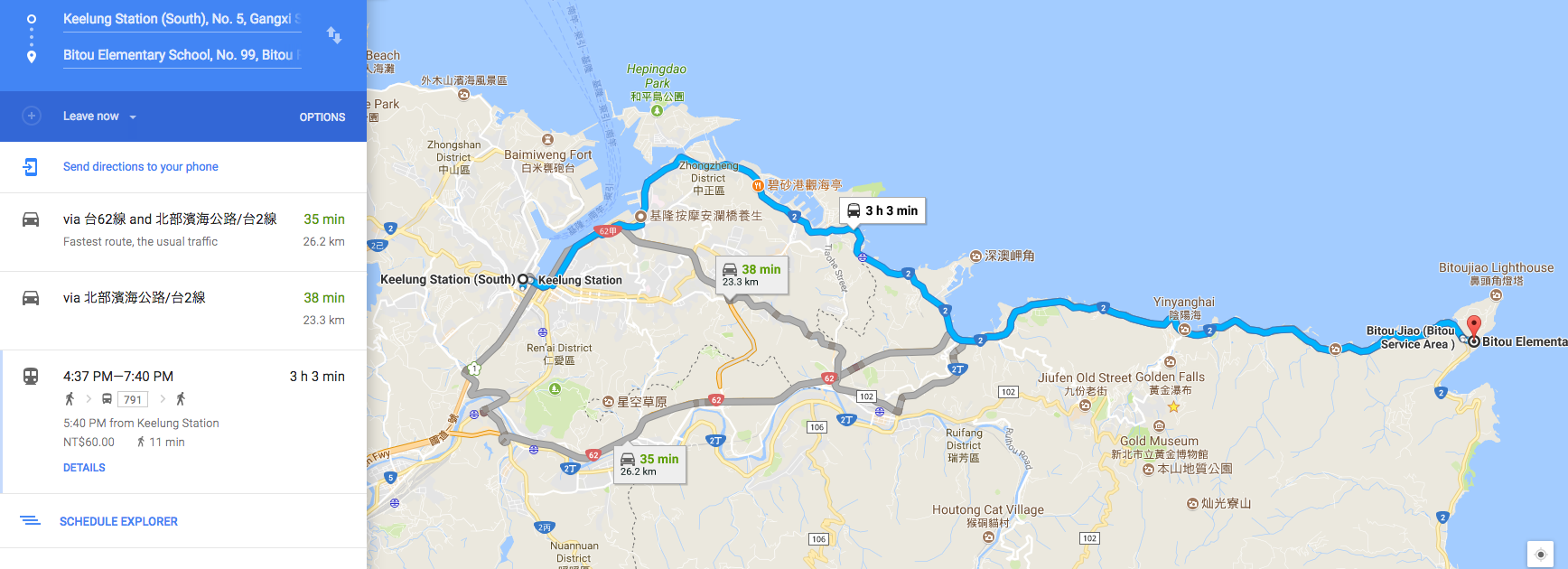
Back to the hike anyways, getting to Bitou from Keelung takes about an hour and a half, if traffic is good. If it's closer to the afternoon and rush hour you can expect it to take around 3 hours. The best way is to take 791 bus to Bitou harbor. This route goes all along the coastal road and is the most scenic route. I prefer taking this bus to get there, though there are other options that google maps lists.
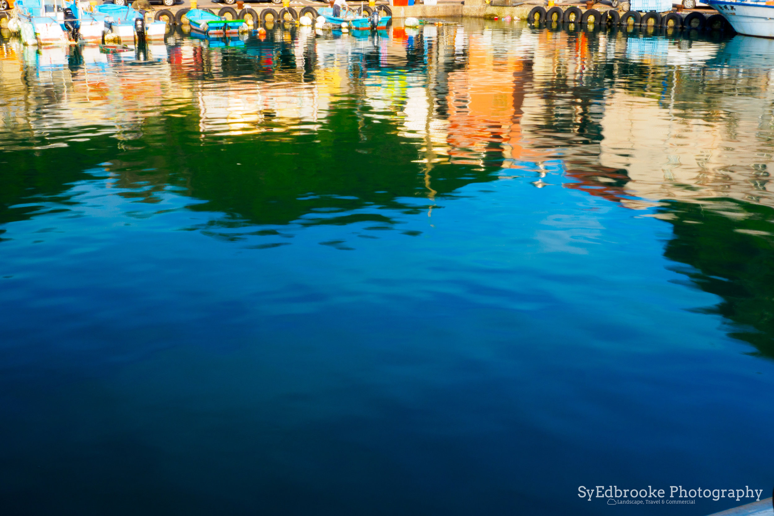
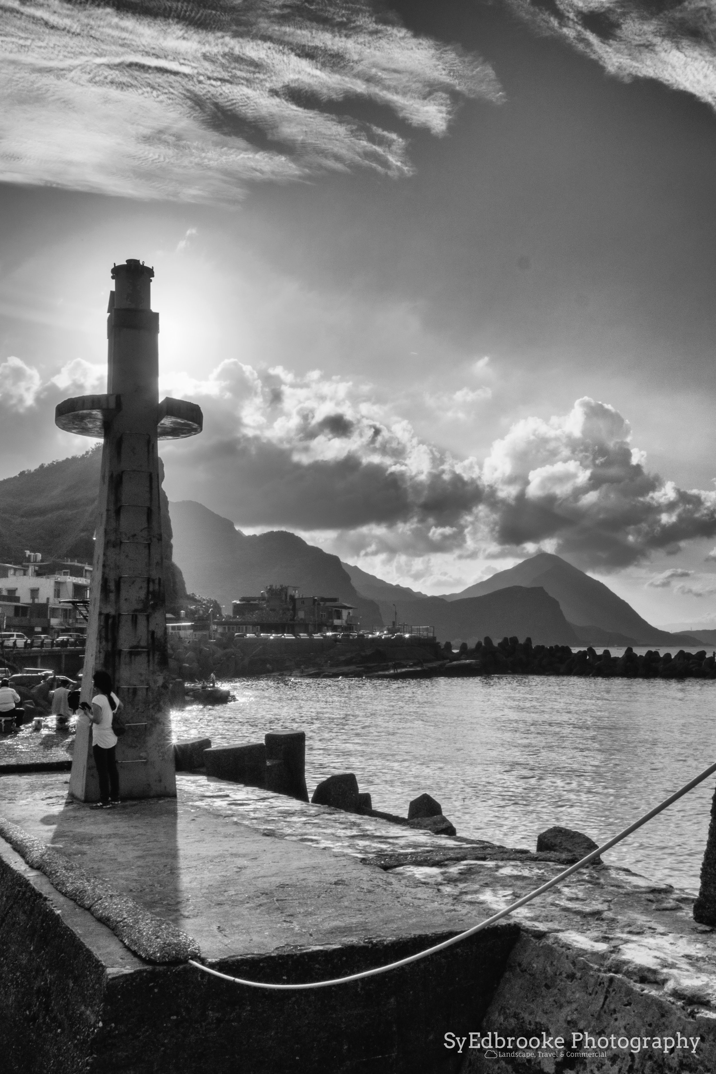
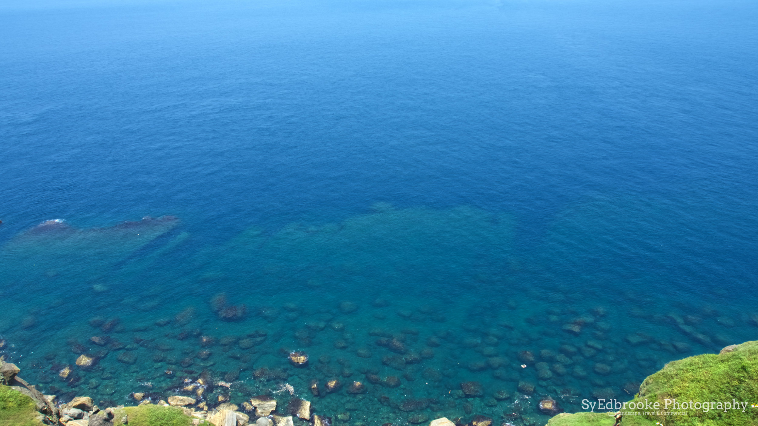
Once you arrive at Bitou, if the water is more or less calm I suggest taking a quick look around harbor. The small town provides an interesting photographic subject, as it seems like it's almost cut into the hills. The reflections from the harbor provide some really interesting compositions! I've hiked here twice now, once in the morning and the other time at sunset. Both times have a different vibe and differ greatly due to the direction of either, the rising or setting sun.

Bitou harbor with Mt. Keelung in the background. f6.3, ISO 100, 1/200, 24mm

Morning light in Bitou. f5.2, ISO 100, 1/160, 28mm

Sunset light at Bitou. f22, ISO 200, 1/15, 24mm
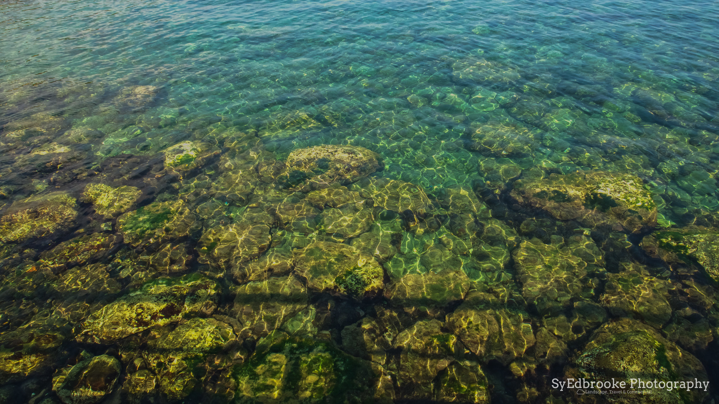
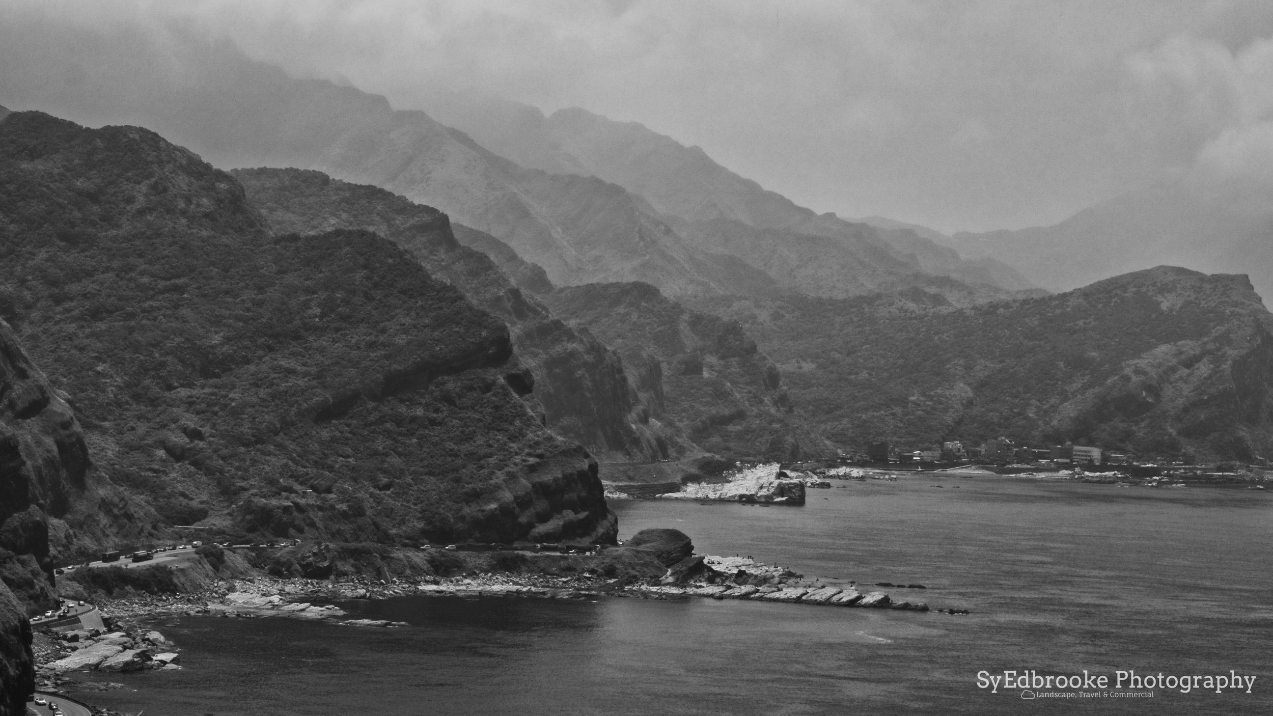
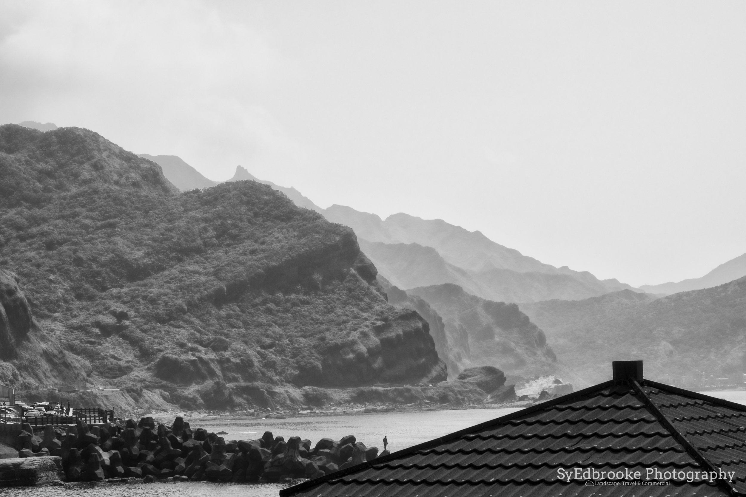
If you go there on a clear day with some clouds in the sky, you can come away with some really dramatic BnW shots. The harbor and surrounding coastline compliment each other nicely. You can shoot the coast line either wide or with a longer zoom, either way you will be able to find some nice compositions!
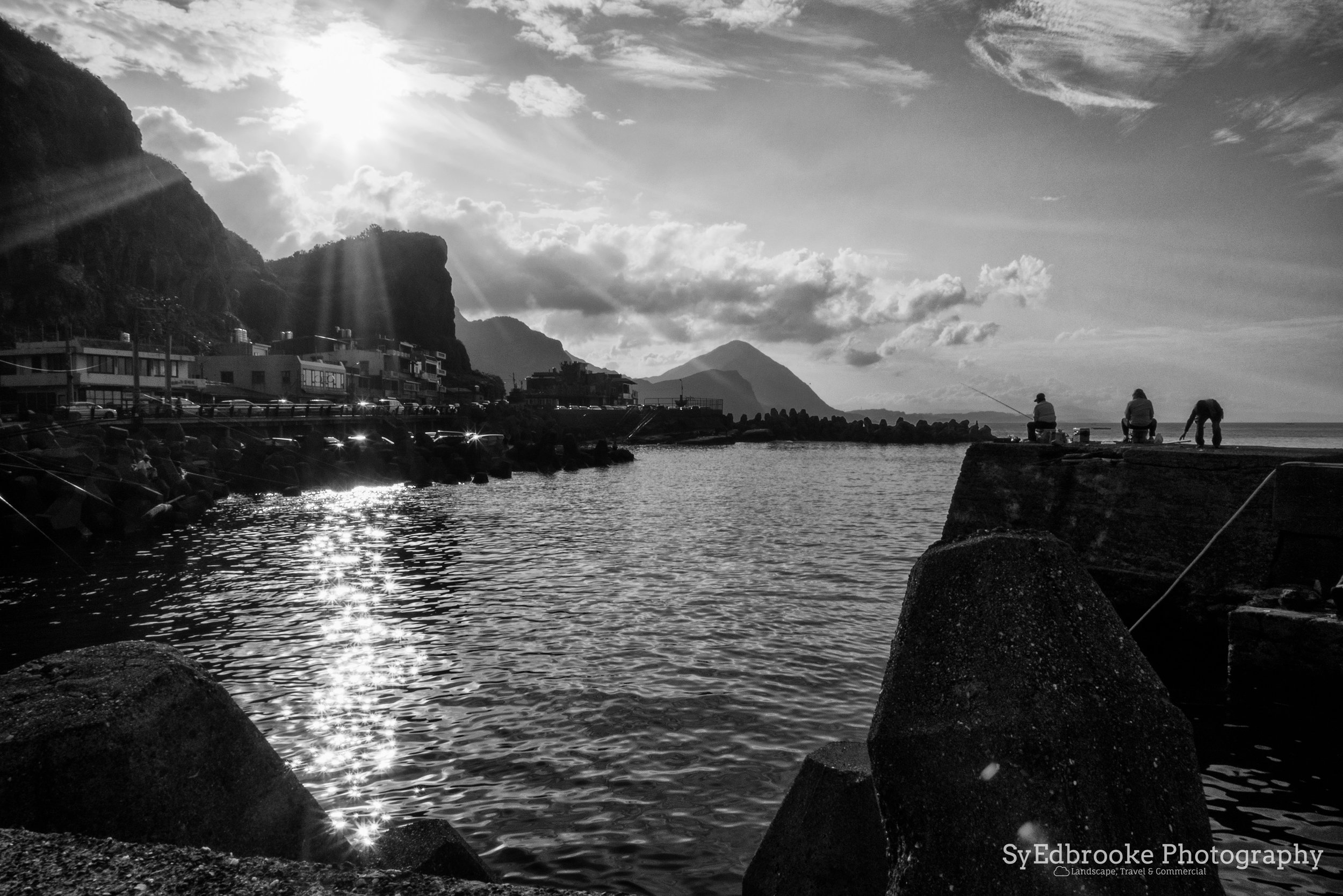

Sun streaming through the clouds. f22, ISO 200, 1/60, 24mm
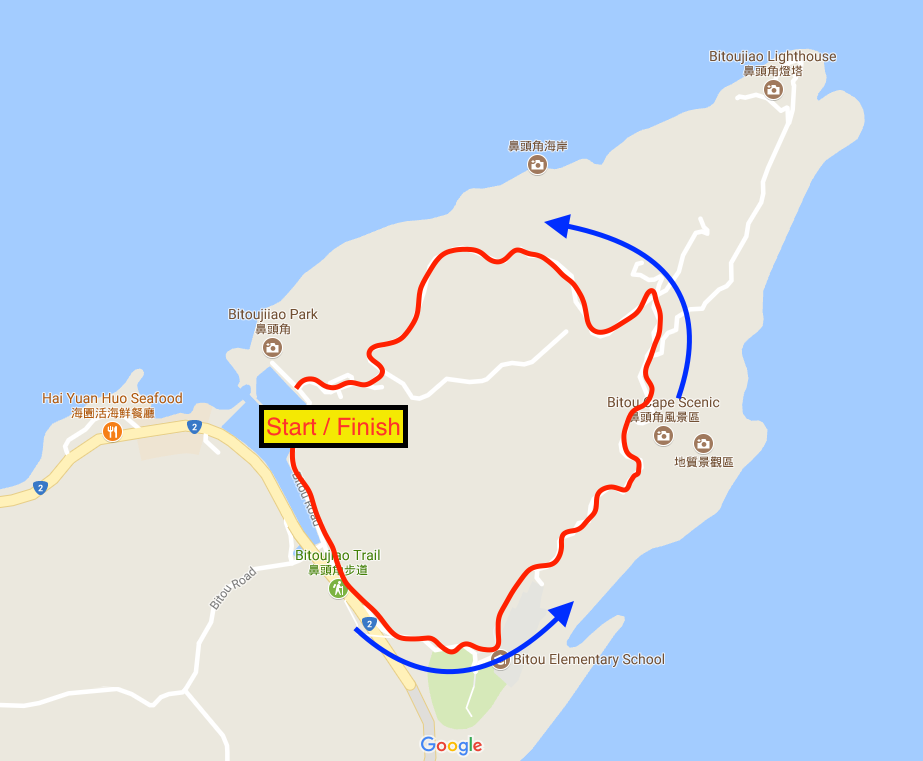
The actual hike starts close to the elementary school on Bitou cape point. The trail is clearly sign posted, and loops all the way around the headland. It's easy to follow and overall a fairly straight forward hike in terms of directions. The path climbs up past the school and along the point, gradually gaining elevation. Its not the steepest hike you'll ever do, but on a hot day I would advise you bring a fair amount of water, sunscreen and a hat. There are some pagodas dotted around the trail at certain points, but they tend to be small and occupied with other hikers.
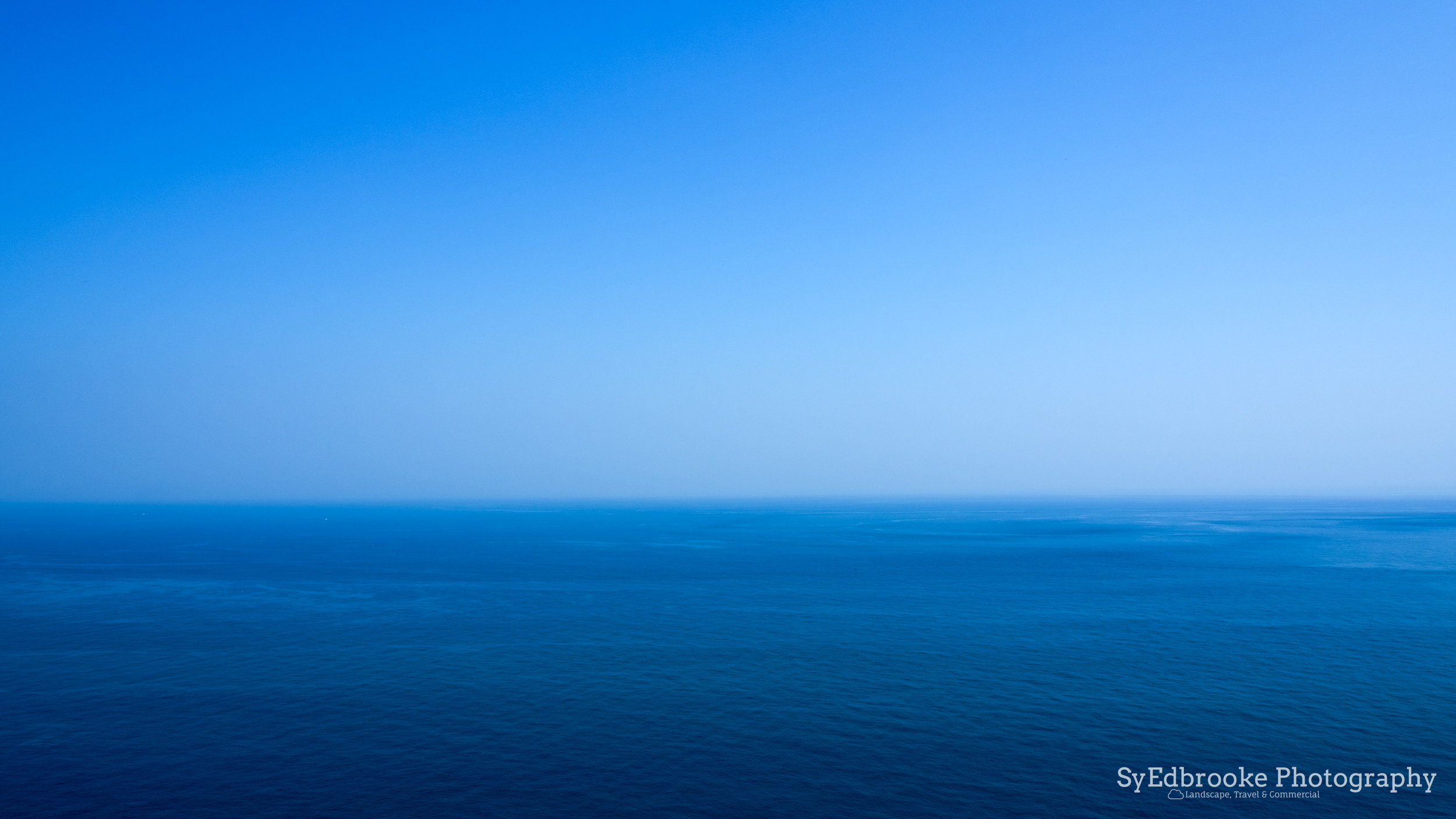
This side of the cape looks towards Fulong and the east coast, where as, the later stage of the hike faces Keelung. This means you get lovely views the coast stretching off into the distancein both directions. Sometimes the haze can be a bit of a problem, so I would suggest you take polarizer to cut through the glare off the water and dirty air. The first time I hiked there, I only had a UV filter, so quite a few of the pictures weren't as clear as I would have liked.
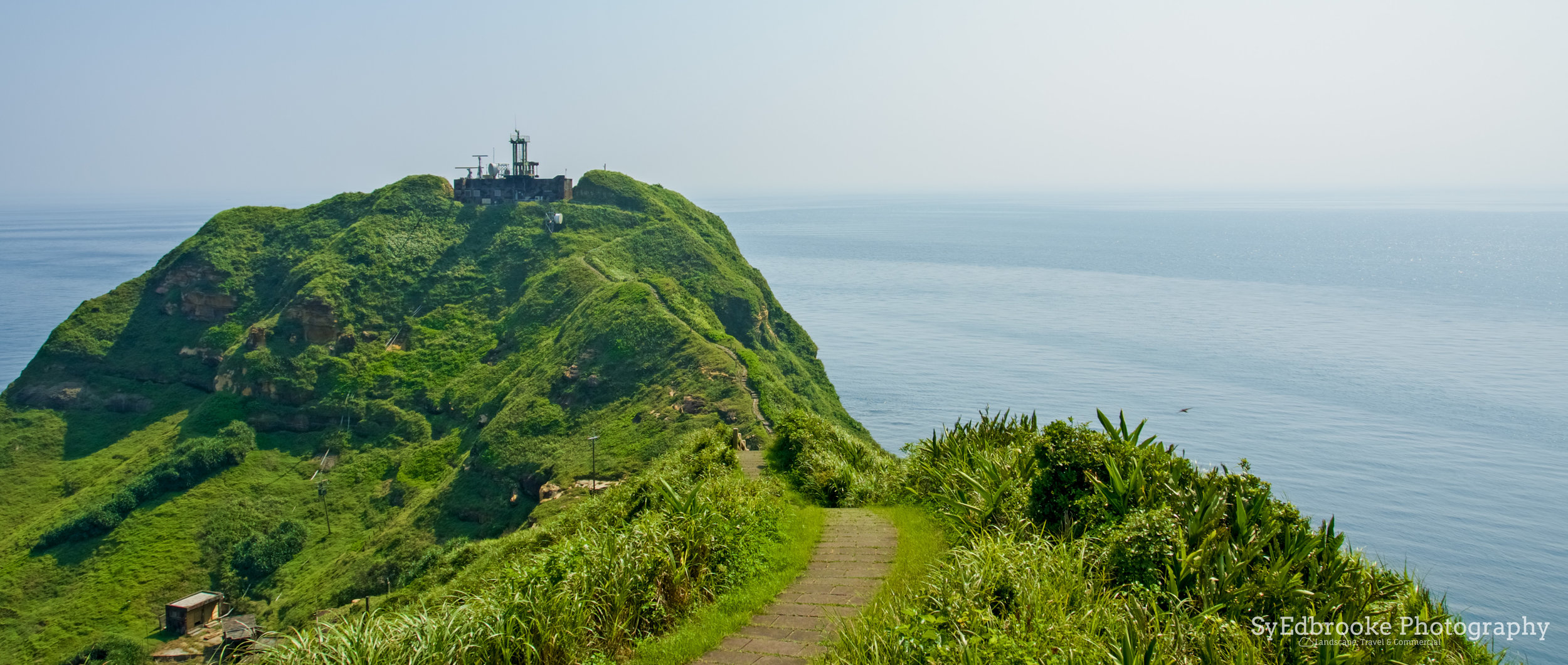
The path weaves it's way up towards the highest point of the headland after about 40 mins of walking. Sadly it's not possible to photograph the lighthouse as the area beyond this has been sectioned off for an army outpost.

The coast looking towards Fulong. f3.5, ISO 100, 1/400, 90mm

A storm is brewing. f22, ISO 200, 1/15, 80mm

Middle of nowhere. f22, ISO 200, 1/13, 24mm
Once past the peak, the trails snakes over a few little hills and leads towards the last rest stop on the hike. The second time I hiked here, this part of the trail was under construction, so proved a little difficult to navigate. I don't know now if the repairs has been completed, but seeing as I last was there at least six months ago, I would hope so!
This viewpoint has a fantastic view of Mt. Keelung and the setting sun. If the light is just right, it sets beyond Teapot mountain and JiuFen, which creates this dramatic sky if the clouds can catch some of the light. I found it was possible to get a really pretty starburst effect shooting here on a higher aperture (anywhere from f11 to f22). This is another of my favourite sports to sit and relax. It's one the most remote / quiet places I've hiked in Taiwan. The sound of the ocean, the wind rustling the long grass is calming and the view is just picturesque.
At anytime of the day it is a fantastic place to relax at, whether that is sunset, morning or midday! The photos speak for themselves I think!

The last rest stop perched on top of Bitou. f7.1, ISO 200, 1/320, 24mm

My favorite BnW photo I've taken to this day, Mt, Keelung. f22, ISO 200, 1/40, 150mm

Sunset perfection. f22, ISO 200, 1/30, 24mm
The path towards the harbor from here leads down the mountain fairly quickly. It is about 20 mins from this point to the harbor where the hike started. Compared to other hikes I've already covered, I would say Bitou is a middle size hike. The complete the entire thing, walking at a normal pace would take about 2 hours and a half hours probably. If you want to speed run it, you could cut that down to an 1 1/2 at best I'd say, although you'd need pretty good cardio levels to do that.

the path leading back to the harbor. f16, ISO 200, 0.5, 66mm

The pulley for the construction of the new viewpoint. f5.6, ISO 200, 1/10, 24mm

Sunset temples at the end of the trail. f22, ISO 200, 1/10, 68mm
As I mentioned at the top of the guide, Bitou is, and will always remain one my favorite hikes here in Taiwan. It takes a while to get to from Taipei, but it is worth it for the views on offer. Any time of the day you are likely to come away with beautiful pictures. The landscape here is incredibly photogenic and lends itself nicely to a variety of styles of photography. The bus on the way back can be slow due to evening traffic on the coastal road, but the view makes up for it!
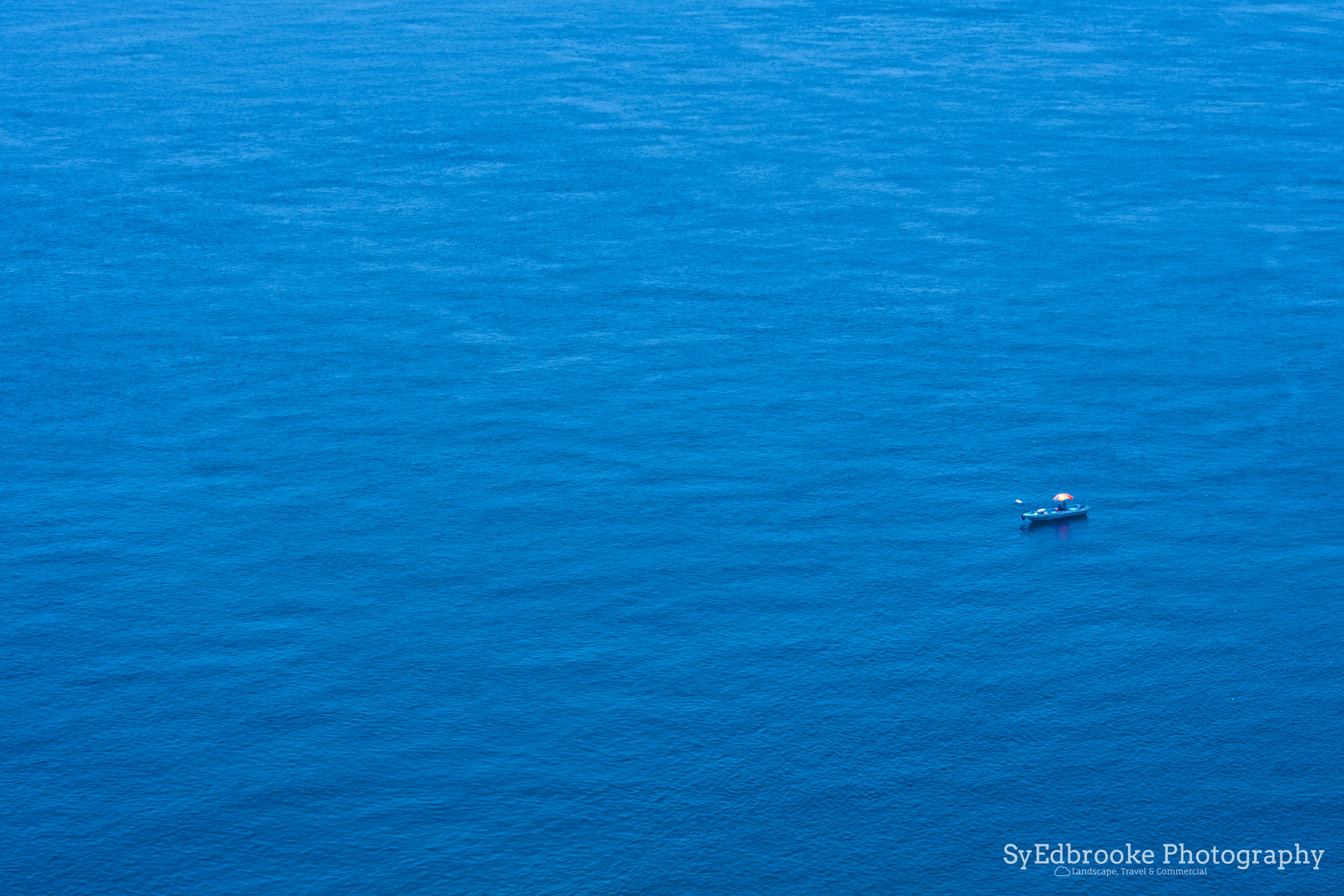
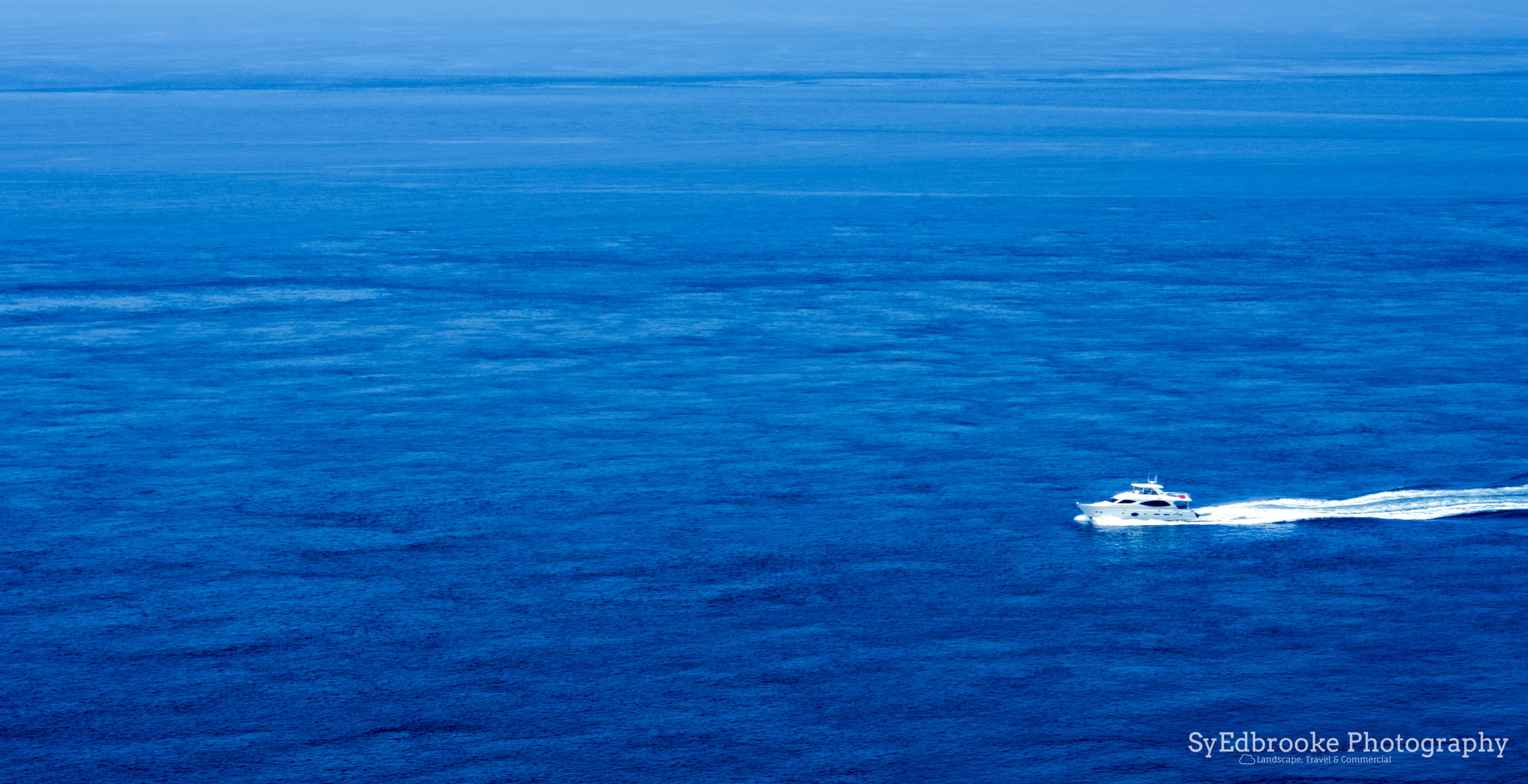
If you are looking for a intermediate hike that's a little more challenging than the well known spots like Elephant mountain or Mt. Keelung, this is a good starting point to start. Just remember to bring lots of water and protection against the sun! It gets very hot here during most of the year. If you are feeling adventurous, there is a section of the coast where you can go for a swim, and even take scuba diving lessons. Sadly I didn't pack my board shorts last time I hiked here, otherwise I would have gone for a swim to cool off after my hike.
I hope this inspired you to go out and explore! If you want any more tips on Bitou feel free to drop a comment down below, and I'll do my best to help out!
Until next time, happy trails!
Sy Edbrooke ^^